RUVIRA OFFSHORE INSIGHTS · ARTICLE 05

SURVEY & GEOPHYSICAL PROFESSIONALS · 5 MIN READ

What the AI in your survey software is actually doing.

Machine learning is now integrated into Qimera, CARIS and EIVA. Most survey professionals are running it without knowing what it does or where it fails. Here is an honest breakdown.

SURVEY & GEOPHYSICS • SEABED BATHYMETRY • ML ALGORITHMS
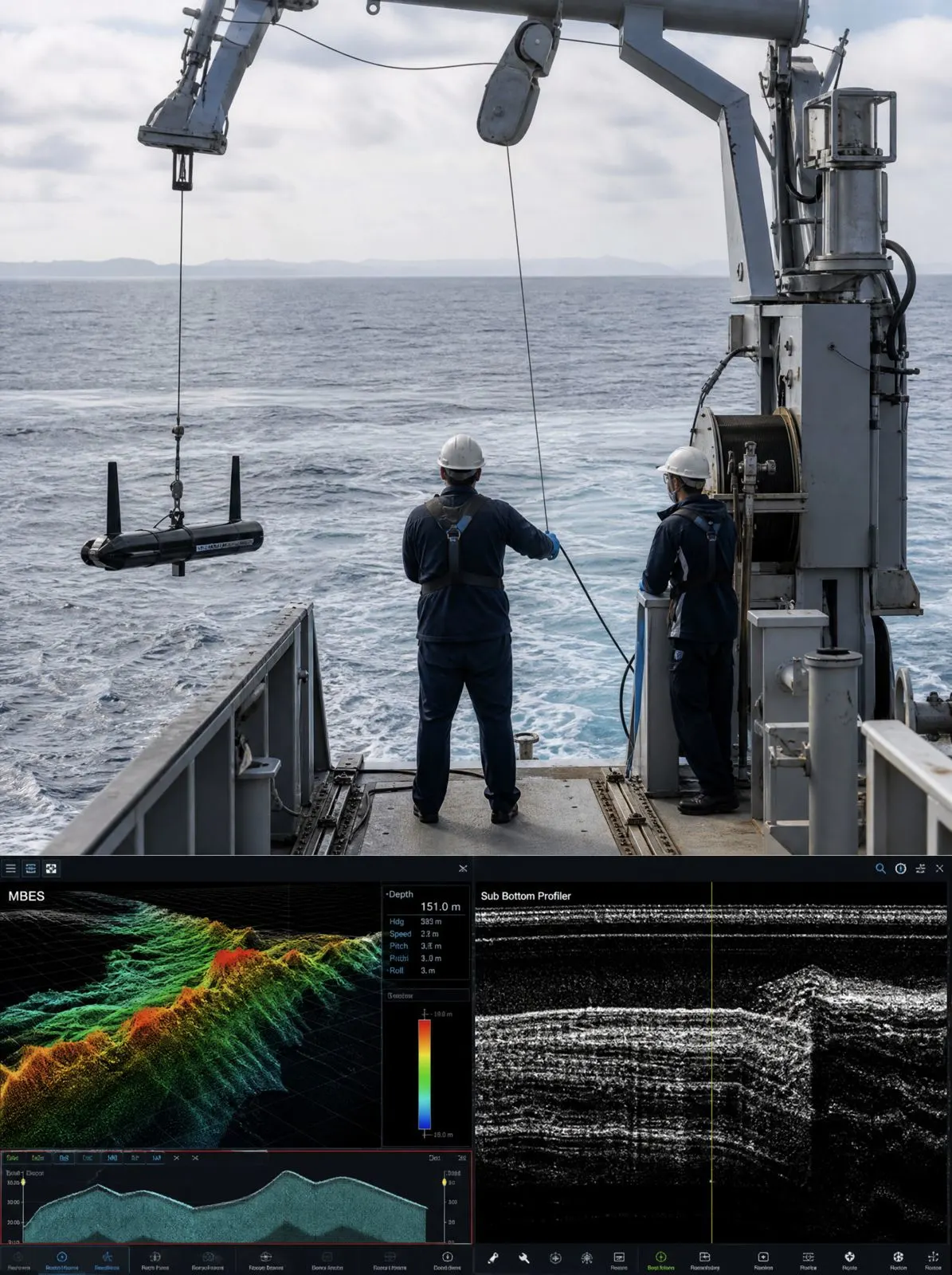
Large monitor showing 3D seabed bathymetric map with colour depth contours and classification overlays, survey vessel control room environment

There is an honest version of this conversation that most training materials do not have. Most survey professionals working with Qimera, CARIS or EIVA in 2026 are running AI-assisted processing.

The machine learning classification tools are in the standard workflow, not a separate module you opt into. They are running whether or not you have received any training on them.

That is not a criticism of the people running them. The software updates outpaced the training infrastructure. OEM certification syllabi were written before these features existed or cover them in a single module that does not address production use. The result is that a meaningful number of competent survey professionals are validating outputs from processes they have not been formally trained on.

This article is an attempt to close some of that gap.

What the machine learning tools are actually doing

In Qimera, the Dynamic Surface and integrated ML tools are primarily doing two things: automated bottom detection refinement and backscatter classification.

The automated bottom detection uses the sonar geometry, the acoustic return characteristics, and training data to refine the initial bottom pick. On standard seabed types with good acoustic conditions, this reduces the manual cleaning burden significantly. On complex or challenging data, it creates confident incorrect detections that require more careful manual review than unprocessed data would.

The backscatter classification tools — in Qimera, CARIS Mosaics, or standalone tools like QPS Fledermaus — apply machine learning algorithms trained on labelled substrate datasets. Sand, gravel, rock, shell: the classification is generated from acoustic backscatter intensity and angular response. The tool is making a probabilistic assignment based on training data, not a definitive determination based on ground truth.

The confidence score attached to each classification is meaningful. Most workflows do not treat it that way.

“The tool is making a probabilistic assignment based on training data. That is different from a determination based on ground truth. The difference matters in a certified deliverable.”

Ruvira Offshore Survey Practice · Operational Technical Guidance

Where it fails: Predictable Failure Modes

The failure modes are predictable once you understand what the tool is doing:

1. Mixed Substrate Transitions

Where seabed type changes rapidly within a small area — common in near-shore, estuarine, or post-glacial environments — the ML model assigns its best guess without accurately representing the gradient. Manual review at the transition zones is not optional.

2. Shallow, High-Energy Environments

Acoustic artefacts, multipath effects and aeration in the water column produce data quality issues that automated tools frequently misclassify. The ML model is not trained on noise — it is trained on signal. It will interpret noise as signal with confidence if the characteristics are similar enough.

3. Novel & Deepwater Environments

The classification is only as good as the training data. Unusual seabed types, very deep water with attenuated returns, heavy biological coverage, or sediment types not well represented in the training dataset will defeat the automated classification reliably. The tool does not know what it does not know.

What this means in practice: The automated tools are good at the straightforward cases and wrong in characteristic ways on the difficult ones. The edge cases — exactly the data that requires surveyor expertise to validate — are where the tools create risk rather than efficiency. A surveyor who understands this processes the confident classifications quickly and concentrates review effort on the uncertain ones.

Why this matters for your career

Operators and project managers who understand survey operations are asking different questions in technical assessments than they were three years ago. Not just whether you are certified on Qimera, but whether you have used the ML classification module and how you QC its outputs.

The surveyors who can answer that specifically — with reference to the failure modes, the confidence score interpretation, the QC workflow in a certified deliverable — are the ones getting the senior and lead calls.

If this is a gap in your current experience, it is a trainable one. What it requires is a programme that goes beyond the OEM certification — one that treats the AI features of the platform as the primary subject rather than a footnote, and is delivered by people who have run these tools in production survey environments.

SPECIALIST TRAINING PROGRAMME

Master AI for Bathymetric Operations and Geophysics.

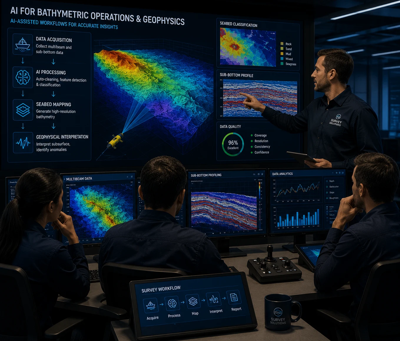
Our AI for Bathymetric Operations and Geophysics programme is built around the ML features of the major processing platforms. Delivered by survey practitioners, not AI generalists.

MORE FROM RUVIRA INSIGHTS

Related Technical Analyses.

View All Insights